
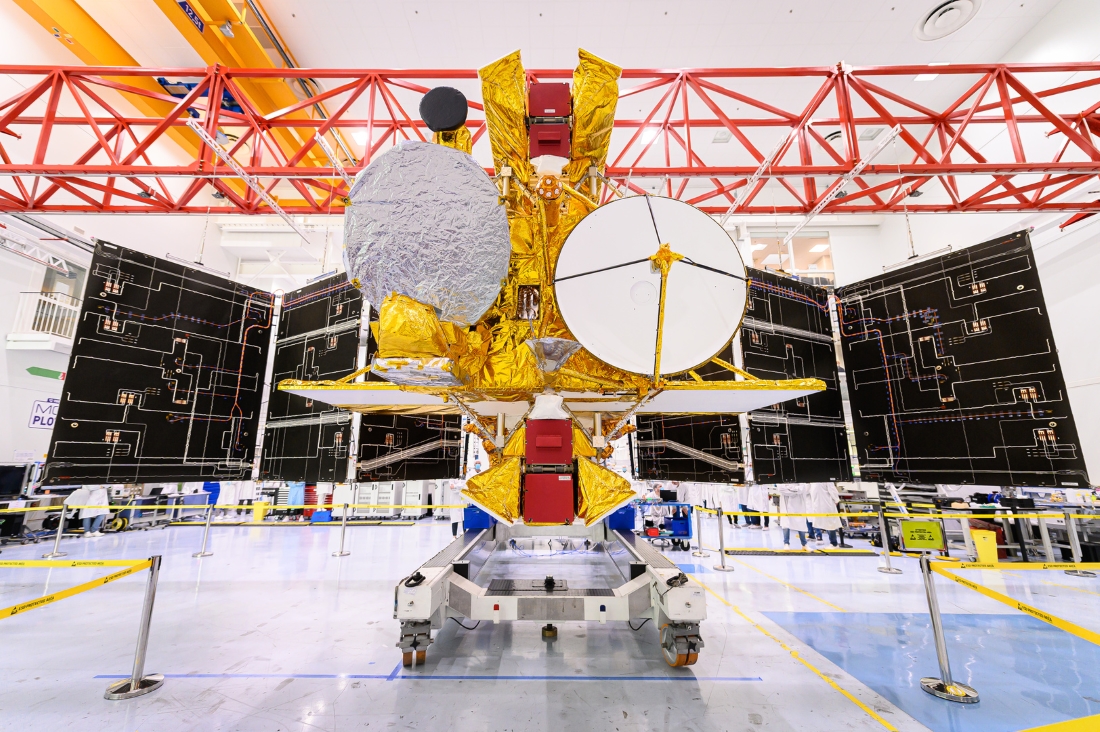
On Dec. 15, 2022, at 6:46 a.m. EST, the Surface Water and Ocean Topography (SWOT) satellite will launch from Vandenberg Space Force Base in California. A collaboration between NASA and the French Space Agency, Centre National d’Études Spatiales (CNES), the Canadian Space Agency (CSA) and the UK Space Agency are also contributing to the mission.
The SWOT Mission
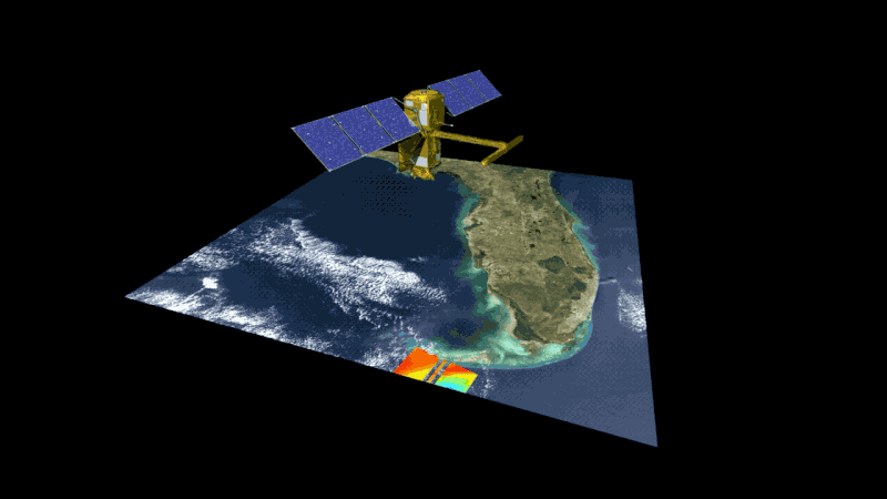
SWOT will help researchers determine how much water Earth’s oceans, lakes and rivers contain, which will aid scientists in understanding the effects of climate change on freshwater bodies as well as the ocean’s ability to absorb excess heat and greenhouse gases like carbon dioxide. All data collected by SWOT, as well as the tools used to collect and analyze the data, will be free and accessible by the public.
This is the first satellite mission to observe nearly all water on Earth’s surface, measuring the height of water in lakes, rivers, reservoirs, as well as the ocean. Collecting this information was previously unachievable because there has not been adequate systems in place.
Redwire Technology Enabling SWOT Mission
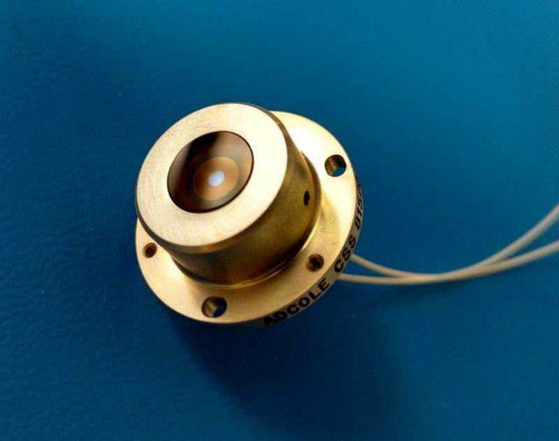
Redwire provided critical navigation technology, developed at its Marlborough, MA facility, for the SWOT satellite, which includes eight standard cosine type detectors. The detectors were delivered to Thales Alenia Space, the prime contractor for the SWOT satellite mission. These sun sensors will provide the SWOT mission with sun presence and sun angle data for sun acquisition, solar array pointing, and failsafe recovery necessary for successful operations. Redwire has a long history of supporting Earth-observation missions with its sensors for nearly four decades.
Empowering Better Resource Allocation
Satellite remote sensing has become an essential operational tool for weather forecasting and climate change research through mapping, supervising, and monitoring the Earth, while also helping scientists study the effects of climate change on the planet. The upcoming SWOT mission will go steps further by surveying more than 90% of Earth’s water supply, and in turn, changing the way we view water on Earth and paving the way for us to make well-informed critical decisions about water resource allocation and management here on Earth.
Learn more about Redwire’s Coarse Sun Sensor (Cosine Type) technology
Learn more about the SWOT Mission from NASA
Related News: Redwire’s Critical Components Enabling GOES-T Mission for Advanced Earth Monitoring


